
Resources for Local Communities and Governments
 Local Waterfront
Revitalization Program
Designated Waterways
Laws & Regulations
Consistency Decisions
Public Notices
Frequently Asked Questions
Contact Us
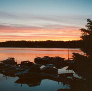
The Town of Irondequoit Local Waterfront Revitalization Program is a locally prepared comprehensive land and water use plan for the Town's natural, public, and developed waterfront resources along the Lake Ontario, Irondequoit Creek, and Genesee River.
The Town of Irondequoit LWRP refines and supplements the State's Coastal Management Program and provides a comprehensive framework within which critical waterfront issues can be addressed, and planned waterfront improvement projects can be pursued and implemented. The approval history of Irondequoit LWRP was published in a final public notice.
The highlighted text is a download link for the fulll Town of Irondequoit LWRP document.
The links below provide easy access to each part of the Town of Irondequoit LWRP, as approved in 1988:
Section I. Inventory and Analysis
Section II. Boundary Map and Description
Section III. Local Policies and Applicable State Policies
Section IV. Proposed Land and Water Uses and Proposed Projects
Section V. Techniques for Local Implementation of the Program
Section VI. State and Federal Actions and Programs Likely to Affect Implementation
Section VII. Summary of the Town's Consultation with Other Agencies
Section VIII. Local Commitment
The Town of Irondequoit is currently preparing a Waterfront Development Plan, as part of the Town’s Comprehensive Plan update, to establish priorities and guidelines for development of underutilized sections of the waterfront and offering opportunities for recreation, improved public access, and economic development.