
Resources for Local Communities and Governments
 Local Waterfront
Revitalization Program
Designated Waterways
Laws & Regulations
Consistency Decisions
Public Notices
Frequently Asked Questions
Contact Us
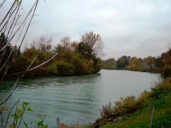
The Town of Wheatfield Local Waterfront Revitalization Program is a locally prepared comprehensive land and water use plan for the Town's natural, public, and developed waterfront resources along the Niagara River and Tonawanda Creek/Erie Canal.
The Town of Wheatfield LWRP refines and supplements the State's Coastal Management Program and provides a comprehensive framework within which critical waterfront issues can be addressed, and planned waterfront improvement projects can be pursued and implemented. The approval history of Town of Wheatfield LWRP was published in a final public notice.
The highlighted text is a download link for the full Town of Wheatfield LWRP document. The links below provide easy access to each part of the Town of Wheatfield LWRP:
Section I. Local Waterfront Revitalization Area Boundary
Section II. Inventory and Analysis
Section III. Local Waterfront Revitalization Program Policies
Section IV. Proposed Land and Water Uses and Projects
Section V. Techniques for Implementation of the Local Program
Section VI. State and Federal Actions and Programs Likely to Affect Implementation
Section VII. Local Commitment and Consultation
Appendix A. LWRP Consistency Review Law
Appendix B. Proposed Zoning Amendment
Appendix C. Standards for Docks on the Canal System
Appendix D. Aerial Photos of Shoreline
Appendix E. Guidelines for Notification and Review
Appendix F. SEQR Process
Map Gallery
The Town of Wheatfield is currently concentrating its efforts on increasing public access to its Niagara River waterfront and developing a multi-use pathway that would be a segment in the regional Niagara River Greenway system.