
Resources for Local Communities and Governments
 Local Waterfront
Revitalization Program
Designated Waterways
Laws & Regulations
Consistency Decisions
Public Notices
Frequently Asked Questions
Contact Us
 The New York City Waterfront Revitalization Program (WRP) refines and supplements the State's Coastal Management Program (CMP) and provides a framework within which critical waterfront issues can be addressed, and waterfront improvement projects implemented.
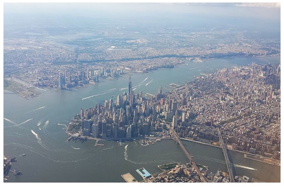
The New York City WRP serves as a long-term management program for the City’s 520 miles of natural, public, redeveloping and working waterfronts, and waterways in between. The program identifies specific projects needed to revitalize the waterfront. As a result, the NYS Department of State will improve its ability to work with the City to protect and revitalize the working waterfront, and protect habitat, natural resources, and water quality.
The City’s original 1982 WRP was the first to be incorporated into the State’s CMP. The WRP was subsequently amended in 2002 to update the city’s vision for its waterfront as reflected in the first Comprehensive Waterfront Plan (1992), companion Borough Waterfront Plans (1993-1994), and new waterfront zoning. Updated again in 2013, the NYC WRP enhances policies to advance the long-term goals laid out in Vision 2020: The New York City Comprehensive Waterfront Plan, released in 2011. The changes demonstrate New York City’s leadership in the area of sustainability and climate resilience planning, as one of the first major cities in the U.S. to incorporate climate change considerations into its Local Waterfront Revitalization Program. The WRP maps five special use areas in concert with associated policies that promote a range of ecological objectives and strategies, facilitate interagency review of permitting to preserve and enhance maritime infrastructure, and support a thriving, sustainable working waterfront. The final public notice published on July 6, 2016 in the New York State Register includes the approval history of the New York City WRP.
The highlighted text is a download link for the full New York City WRP document. The links below provide easy access to each part of the New York City WRP, as amended and approved in 2016:
INTRODUCTION
PART I: PROGRAM DESCRIPTION
PART II: THE POLICIES
PART III: MAPS
1. Coastal Zone Boundary Maps
2. Special Natural Waterfront Areas Maps
3. Significant Maritime and Industrial Areas Maps
4. Arthur Kill Ecologically Sensitive Maritime and Industrial Area Maps
5. Priority Marine Activity Zones Maps
6. Recognized Ecological Complexes Maps
APPENDIX A: State and Federal Actions and Programs Which Should Be Undertaken in a Manner Consistent with the LWRP
APPENDIX B: Local State and Federal Regulations Related to the Implementation of the LWRP
The New York City WRP was prepared in collaboration with the NYS Department of State and adopted and approved pursuant to the provisions of Article 42 of the Executive Law and its implementing regulations.